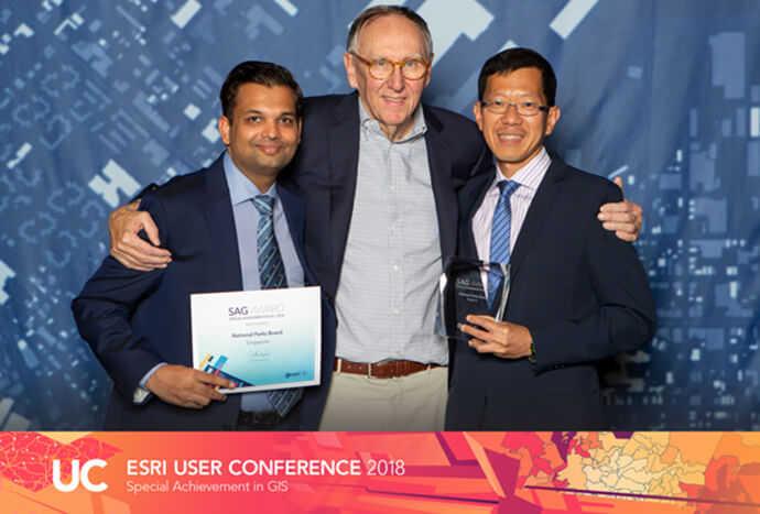
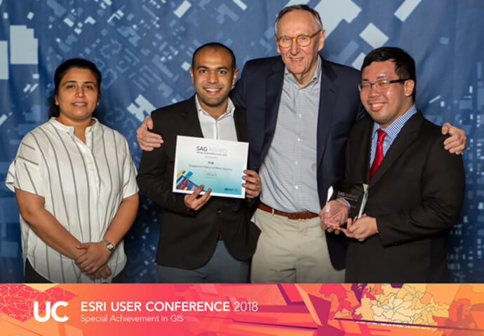
Singapore's National Parks Board (NParks) and PUB, Singapore's National Water Agency, received the Special Achievement in GIS (SAG) award, in recognition of their innovation and excellence in applying location analytics for improving Singapore's key public services.
Selected from among more than 100,000 organisations worldwide, NParks and PUB were presented with the award by Jack Dangermond, Founder and President of global mapping giant Esri, at the 2018 Esri International User Conference in San Diego.
NParks: Smart maps to encourage appreciation of the City in a Garden
A proponent of geospatial analytics, NParks has utilised the technology since 1999 and in 2016, introduced a programme to promote its adoption across the organisation. This gave rise to MAVEN, a platform that consolidates all geospatial databases.
MAVEN is a single repository that stores information such as park planning and facilities data, tree information, biodiversity data, vegetation maps and satellite maps. With MAVEN being accessible on mobile devices, updated information on trees, parks and gardens are easily available on-the-go as officers carry out their operations on-ground.
The agency’s application of smart maps goes beyond internal operations to involve Singapore residents as well. For example, members of the public can submit biodiversity sightings via the SGBioAtlas mobile application. These reports are consolidated with input from government agencies, educational institutions and non-governmental organisations (NGOs) on BIOME, which stores biodiversity and environment related data, and maps the distribution of flora and fauna in Singapore.
Another platform, trees.sg, enables local residents to learn about and appreciate more than 500,000 of Singapore’s trees. This interactive map also allows users to share their photos and stories about the trees, as well as view contributions by others.
NParks’ Assistant Chief Executive Officer, Mr Tan Chong Lee, said, “With operations spread across a network of roadside greenery, four nature reserves and 350 parks, NParks recognises the importance of tapping on geospatial technology for efficiency. We are honoured to receive the Special Achievement in GIS award, as it affirms our efforts to leverage on smart maps as we work towards realising our biophilic City in a Garden vision.”
PUB: Location analytics for managing Singapore’s water supply
Over at PUB, Singapore’s national water agency ensures a diversified and sustainable supply of water for Singapore through four sources of water – local catchment water, imported water, NEWater and desalinated water.
To support water operations, infrastructure planning and business processes, the agency worked with ESRI to develop a customised solution for Singapore’s integrated water management requirements.
This led to the development of the Geographic Resource Information System (GERI), designed to provide an overview of PUB’s used water, drainage and water infrastructure with a comprehensive digital representation of the islandwide network such as pipes, meters, valves and other critical facilities.
The implementation of the GERI system has reaped several key benefits for PUB. GERI provides PUB officers with both geospatial asset and operational information to make informed decisions and take relevant actions.
Michael Toh, Chief Information Officer, PUB, said, “To better serve our customers, geospatial technology is one of the technologies used daily by our engineers for planning, operation and maintenance work. For example, our Engineers can access asset information such as critical pipelines, incident history, as-built drawings, material, profile and age to plan operations, maintenance and infrastructure renewal works. In addition, GERI’s location analytics algorithm further enhances productivity, by automatically identifying PUB’s network infrastructure underground and above-ground located within upcoming developments. This allows PUB to safeguard our existing infrastructure by alerting the relevant parties.”
“Location-based analytics underpins the planning and development of many cities around the world,” shared Thomas Pramotedham, Chief Executive Officer, Esri Singapore. “And the principle that guides their decision-making stems from a concept called Smart City thinking that’s increasingly becoming more relevant today as cities and nations such as Singapore drive innovation to improve the quality of life in our communities.”
“NParks and PUB are great examples of organisations that have embraced this concept by using geospatial technology for the benefit of the wider public, and we look forward to supporting more organisations in driving innovation and sustainability in our urban environments.”