CityEngine is advanced 3D modelling software for creating huge, interactive and immersive urban environments in less time than traditional modelling techniques. Cities created in CityEngine can be based on real-world GIS data or showcase a fictional city of the past, present, or future.

Create entire 3D cities

CityEngine powers rapid adjustments to the architectural style or other features of your city so you can easily create multiple design scenarios.

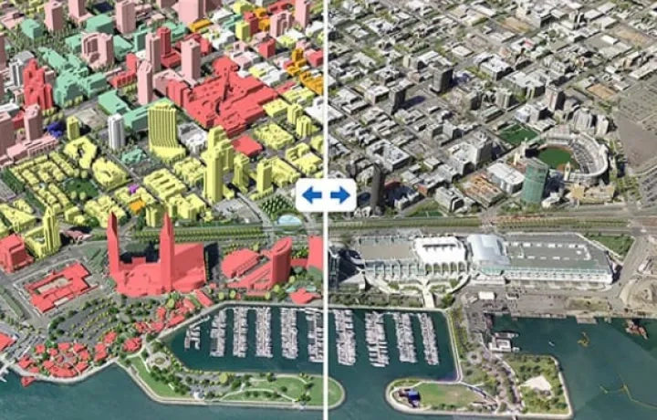
Design urban environments

Make 3D models to show planned changes and alternate designs. Inform your designs with 3D representations of regulatory and land use conditions. Share multiple design alternatives with your team or stakeholders to gather feedback.
city-engine

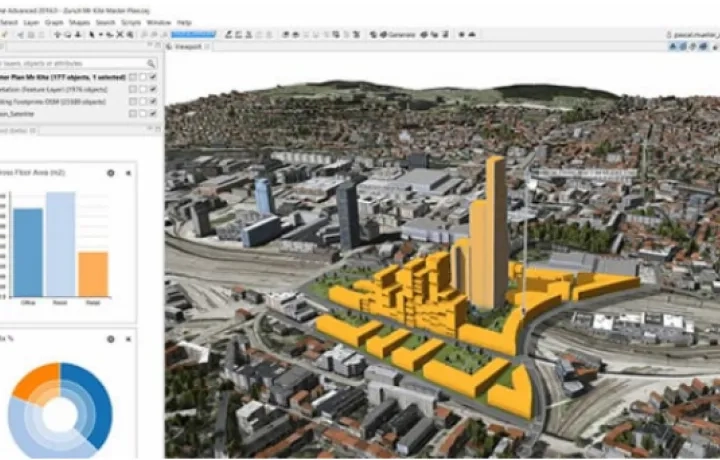
Master 3D content creation

CityEngine integrates smoothly with your current creation pipeline. Bring in your hero buildings or other assets to build 3D context around them. Export work back into your high-end visualisation software or game engines. Automate your workflows with procedural scripting and Python.
city-engine

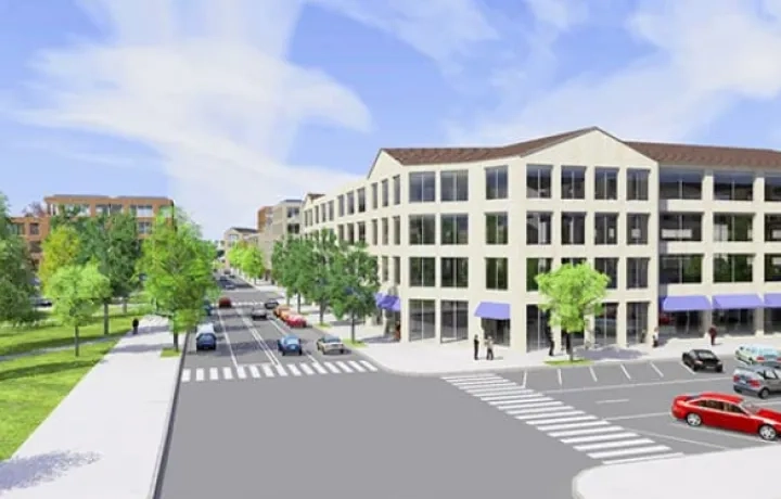
Bring your community vision to life

CityEngine helps you make quality decisions that will benefit your community for decades. Use it to develop creative and dynamic 3D visualisation experiences. CityEngine’s 3D visualisation power shows you project relationships, feasibility, and implementation.
city-engine

Interested in a free trial? For more information email an expert at or call us on 6742 8622.

Build a city in five steps

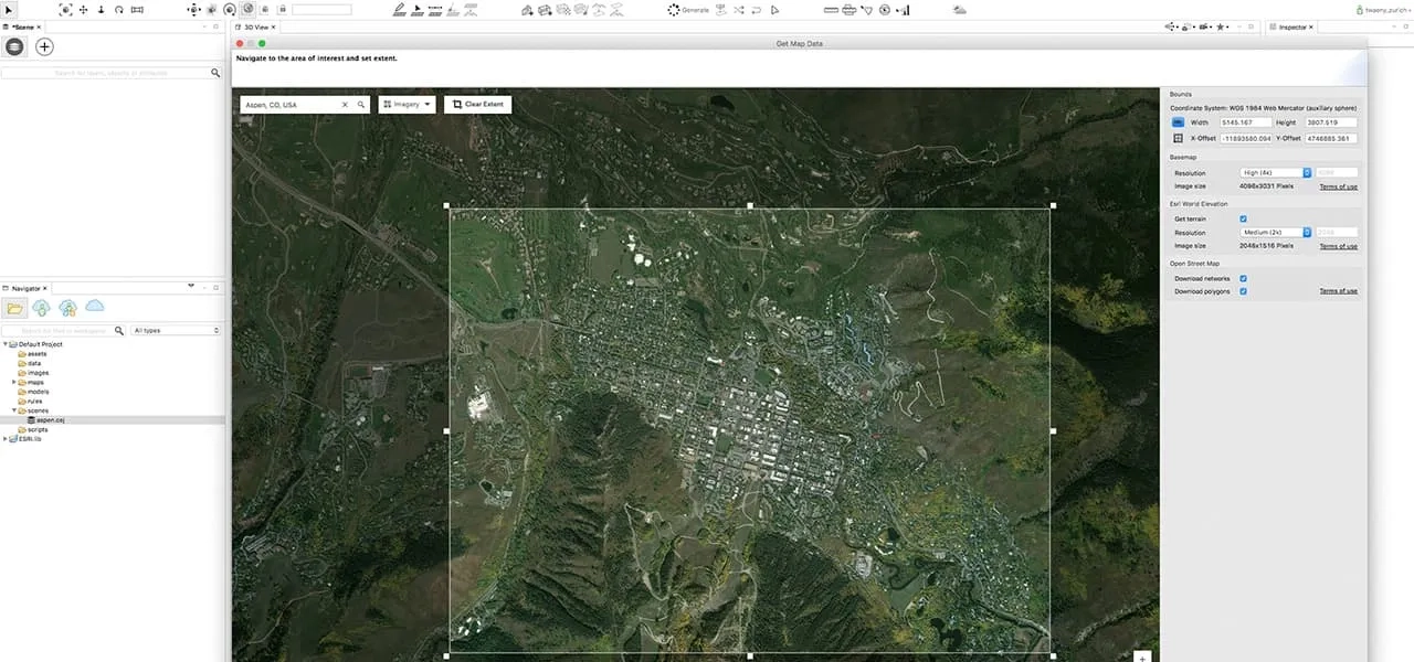
Step one

Find your area of interest. Use ‘Get Map Data’ to import basemap and terrain data.
city-engine

Step two

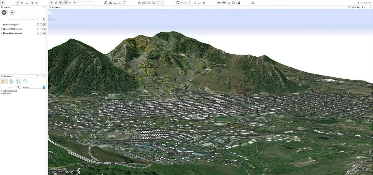
Add or sketch your streets, city blocks, and parcels.    
city-engine

Step three

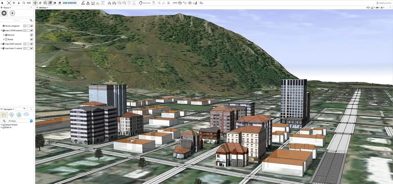
Move 2D data into 3D models. Add rooftops, furniture, vegetation, and other 3D assets.
city-engine

Step four

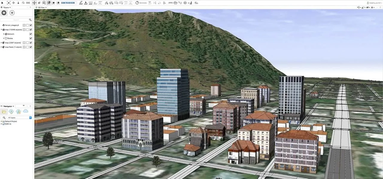
Texturise your buildings and facades. Add more details to your 3D models.
city-engine

Step five

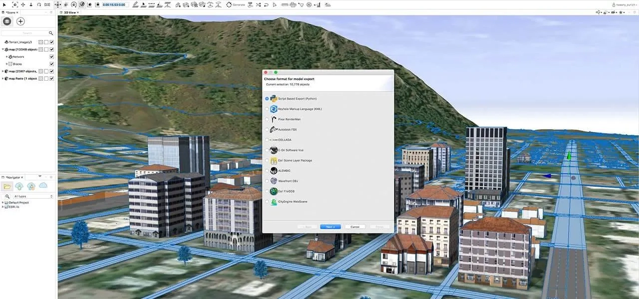
Export your finished 3D city to the web, VR experiences, game engines or a geodatabase.
city-engine

Design with 3D modelling tools

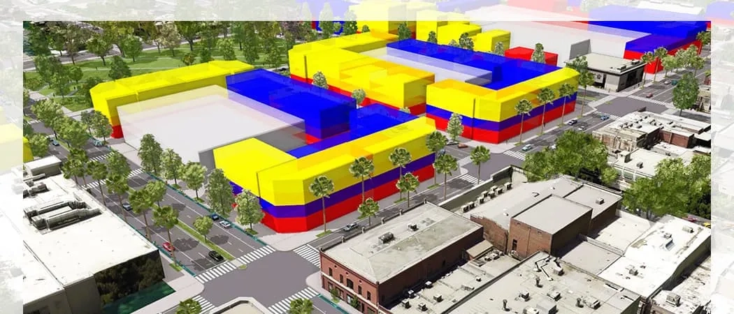
Create beautiful real-world or imaginary environments easily. Save time by building large urban environments with procedural modelling and scripting.
city-engine

Create a city

Make and generate whole cities from pre-defined templates with only a few clicks. The CityEngine city wizard is the easiest way to generate a procedural city.

Get map data

Build 3D mock-ups of cities around the world in minutes. Use an ArcGIS Online subscription to clip out and import satellite imagery and 3D terrain. Also, import street and building footprint data from OpenStreetMap.

Edit on the fly

Sketch and texture 3D building models with the editing tools included in CityEngine. New 3D geometries you create can be saved back into the File Geodatabase.

Texture facades

Author building facade rules from images or existing textured models. Facade rules can be applied to other building designs. Extend your rules with more details and use them to report building information.

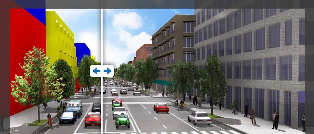
Visualise and measure scenarios

Create multiple design alternatives within a single scene and compare them. Display scenarios side-by-side for visual comparison and analysis.
city-engine

Measure in 3D

Measure distances, areas, and paths with interactive tools. All measurement tools include 'laser lines' to see and quantify the heights of 3D objects relative to other objects.

Generate reports

Compare planning proposals and analyse designs. Generate customised rule-based reports to automatically calculate quantities such as density or floor area.

Create dashboards

Customise scenario-aware dashboards and show the reports of multiple scenarios simultaneously. Compare the performance of designs against each other in real-time while designing.

Visualise 3D zoning

Digitise your city or community master plans. Ensure buildings are in compliance with the guidelines. CityEngine allows you to specify, visualise, analyse, and store zoning regulations in 3D.

Maximise integration

Experience seamless integration into your current pipelines and workflows by exporting your CityEngine scenes as industry standard 3D data formats.
city-engine

Work with compatible formats

Integrate with other 3D and CAD tools. CityEngine supports OBJ, Collada (DAE), DXF, as well as VOB for Vue. Collect textures in a single folder for easy reuse and sharing. Collada supports asset instancing, multiple UV-sets, and grouping.

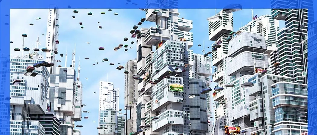
Build cities for games and movies

Import hero buildings and export entire cities. Use Autodesk FBX for exchange to game engines and VFX tools. Export in Alembic or Pixar's RenderMan as well. Supports advanced materials, asset instancing, multiple UV-sets, grouping, binary encoding, and texture embedding.

Connect with ArcGIS

Export 3D object layers as scene layer package (SLPK) files. Upload the SLPK to ArcGIS Online or ArcGIS Enterprise, where a 3D streaming service is created and hosted. View or combine scene layers with additional web layers in other Esri apps.

Showcase your designs

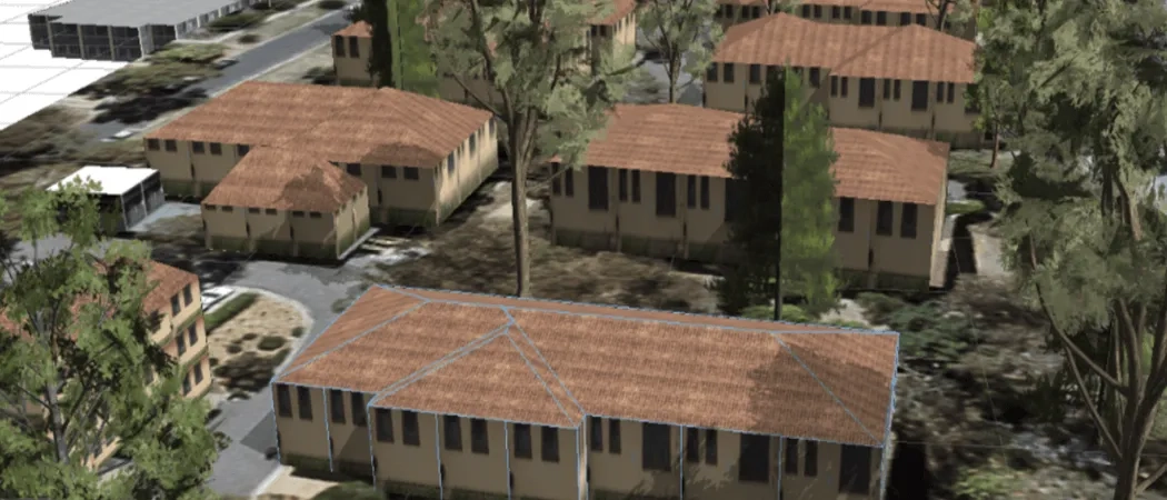
Publish your 3D models online. Others can interact with them, understand your plans and designs, and participate in improving the overall project.
city-engine

Share your 3D city scenes

CityEngine scenes can be published directly to the web for sharing 3D models, analysis results, or design proposals with decision makers or the public.

Dive into virtual reality

Immerse yourself into a virtual 3D city with the ArcGIS 360 VR app. These unique VR experiences are created in CityEngine and hosted on ArcGIS Online. All you need is a simple smartphone paired with a headset.

Subscribe to
Esri Singapore news