Esri Singapore | Home

Main navigation Singapore

  • Industries
    • Commercial
      • Banking and finance
      • Construction
      • Design and engineering
      • Electricity
      • Ports and maritime
      • Real estate
      • Retail
      • Telecommunications
      • Transport and logistics
      • Water
    • Government
      • Climate action
      • Defence and intelligence
      • Health and human services
      • Public safety
      • Smart cities
      • Spatial data infrastructure
      • Urban planning
    • Community
      • Start-up Program
      • Education
      • Esri Young Scholar Award
      • Boustead-Esri Geospatial Scholarship
  • Products
    • Capabilities
      • Digital twins
      • Field operations
      • Imagery and remote sensing
      • Real-time visualisation and analytics
      • Spatial analytics
    • About ArcGIS
      • ArcGIS Online
      • ArcGIS Pro
      • ArcGIS Enterprise
      • ArcGIS for Developers
      • ArcGIS for Personal Use
      • ArcGIS Online free trial
      • See other Esri products
    • Applications
      • Apps for the Office
      • Apps for Field Operations
      • Apps for the Community
      • App Builders
      • NV5 Geospatial
    • Data
      • GIS data
      • Open Data
      • Open Standards
      • Data Interoperability
      • Esri’s Open Vision
  • Services and support
    • Services
      • GeoBusiness Solutions
      • Implementation services
      • Professional Services
      • ArcGIS Enterprise upgrade
      • Disaster Response Program
      • Geo Experience space
    • Technical support
      • Esri Support App
      • Support programs
      • Support resources
      • Support request
    • Training
      • Training calendar
      • Training courses
      • Submit a training enquiry
    • ArcGIS resources
      • A quick-start guide to ArcGIS Pro
      • ArcGIS user types
      • ArcGIS product licensing
  • News and events
    • News
      • Subscribe to news
    • Blogs & podcasts
      • Esri Singapore blog
      • Esri Podcast Network
      • GIS Directions podcast
    • Events Calendar
      • Past event presentations
      • Esri Singapore Connect (webinars)
  • About
    • Esri Singapore
      • Our people
      • Our history
      • Our relationship with Esri
      • Our relationship with Boustead
      • Our partner program
    • GIS technology
      • About Esri
      • Jack Dangermond
      • History of GIS
      • About location analytics
      • Esri map gallery
    • Careers
      • Our values
      • Our people
      • Browse jobs
    • Contact us
      • Sales and services
      • Training
      • Support
      • General enquiries
      • Subscribe
  • Store

You are here

  • Home
  • Safe communities

GIS in safe communities

Connect with a specialist
Safe communities banner illustration

Keep the members of your community safe and secure with a common operating picture and smarter situational awareness through trustworthy real-time location data.


safe-communities
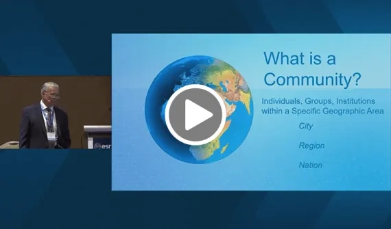
Video Building safe, resilient communities with GIS

Shared, real-time situational awareness is critical for building safe, resilient communities. US expert Russ Johnson shares best practice strategies for actionable intelligence.

More
Designing resilient communities news
News Designing resilient communities

The world's population is on track to spike by more than two billion people over the next 30 years. It's time for decision makers around the world to plan for this growth and to find the most sustainable options for how to use space.

More

Call 6742 8622 or email an Esri Singapore specialist to find out more about how GIS can help keep your citizens safe.

Bridging-the-health-gab-in-Myanmar
Case study National plan to bridge the health gap in Myanmar

Facing wide geographic disparities in health services, Myanmar's Department of Public Health and Sports launched the National Health Plan to strengthen the country's health system.

More
Mitigating disease outbreaks banner
News Smart maps mitigate disease outbreaks Doctors and scientists are using smart maps to learn more about vector borne diseases threatening the world's tropical and sub-tropical regions. Learn more
Esri Singapore | Home

Footer menu

  • Sitemap
  • Privacy
  • Website Terms and Conditions

© 2026 Esri Singapore All rights reserved.