You are here News and events News News Search news Search by year All20252024202320222021202020192018201720162015201420132012 Tags - Any - ArcGIS Pro: Essential Workflows3DABSAECAgileAgribusinessAgricultureAnalyticsAppsAppStudioArcGISArcGIS 10.5ArcGIS 10.6ArcGIS EnterpriseArcGIS Experience BuilderArcGIS Field MapsArcGIS HubArcGIS IndoorsArcGIS KnowledgeArcGIS OnlineArcGIS ProArtificial intelligenceAsset managementAugmented realityAustralian Bureau of StatisticsAutodeskBankingBIBig DataBig Data AnalyticsBIMBorder PatrolBusinessBusiness IntelligenceCadastreCalifornia CoastlineCitizen engagementCloudCloud computingCloud GISCollectorCommercialCommercial propertyCommunityConstructionContentCoronavirusCouncilCOVID-19CrisisCrowdsourcingDataData analyticsData visualisationDeep learningDefence and intelligenceDekhoDesignDigital transformationDigital twinDisruptive appsDronesEducationeLearningElectionElectorateElectricElectricityEmergency managementEmergency responseEmergency servicesEnergyEnergy, oil, gas and renewablesEngineeringEnterprise GISENVIEnvironmental managementEsriEsri AustraliaEsri Petroleum ConferenceEsri UCEsri Young Scholars AwardEventsFacility managementFederal governmentFinancial institutionsFinancial servicesFleet managementFood securityForestryGasGDA2020GDA94Geo hubGeoAIGeoAnalyticsGeoBIMGeographic datumGeographic Information SystemsGeospatial AnalyticsGetting Started with ArcGIS ProGISGIS for schoolsGIS managerGIS server softwareGIS technologyGIS trainingGIS web servicesGovernmentHealthHealth and human servicesHomeland SecurityIcon WaterIDLImageryImpact AwardsIndoor navigationInnovationInsights for ArcGISInsuranceInsurance and BankingInteractive mapsInternet of ThingsInternshipInteroperabilityIntroduction to ArcGIS Pro for GIS ProfessionalsIntroduction to GIS Using ArcGISIoTJack DangermondJavaScriptKerajaan Negeri SembilanLand AdministrationLand managementLaura DangermondLaw enforcementLive dataLive sensorsLocal governmentLocation intelligenceLocation-based analyticsLogisticsMachine learningMapping and chartingMapsMaritimeMediaMicrosoft AzureMiningMobileMobile applicationsMobile GISMount AgungNational developmentNational SecurityNot for profitOH&SOilOpen dataOpen platformOperational awarenessOz MineralsOzriPartnershipPetroleumPETRONASPlanningPortsPredictive analysisProductsPublic safetyPublic sectorQueensland GlobeRaster dataReal-time analyticsRemote sensingResilient communitiesResourcesRetailROISaaSSabah Lands and Surveys DepartmentSafe communitiesSAG AwardsSAPSAR ImagerySARscapeSatellite imageryScholarshipSensorsSituational AwarenessSmart citiesSmart communitiesSmart transportSmarterWXSolar eclipseSpatial data infrastructure solutionsSpeculative designStartupsState governmentStoryStory mapsSupply chain managementSurvey123Sustainable developmentTelcoTelecommunicationsTrainingTransformationTransportTransport analyticsTransport and InfrastructureTransportationUIUnearthed ChallengeUnited NationsUnmanned Aerial VehiclesUrban analyticsUrban planningUser experienceUser interfaceUser researchUtilitiesUtility networkUXUXGVirtual realityWaterWaterfallWeb GISWHO Authorities call for conservation efforts to be mapped Cutting-edge mapping technology is the solution for managing global efforts to protect endangered wildlife and habitats, including Australia's Great Barrier Reef. Learn more MIMOS partners with Esri on national security MIMOS, Esri Inc. and Esri Malaysia sign a memorandum of understanding that will bring the government's R&D efforts in the field of national security to new heights. Learn more Halloween cemetery tour starring history's most notorious Should the dead rise today, which famous person would be on top of your list to meet? Learn more News JUPEM wins SAG award for uGeo JUPEM's Defence Geospatial Division (BGSP) is selected from more than 400,000 organisations worldwide to win a global Special Achievement in GIS (SAG) Award. Learn more News Pertamina EP receives international recognition State-owned oil and natural gas corporation, Pertamina EP, wins the 2014 Special Achievement in GIS (SAG) Award for their innovative use of GIS to improve operational efficiency. Learn more News Geospatial tech supports mission-critical operations A world leading geospatial defence experts advises the region's national security stakeholders on how state-of-the-art mapping technology can help support mission-critical operations. Learn more News New technology to future-proof Iskandar Malaysia The Iskandar Regional Development Authority (IRDA) is leveraging state-of-the-art technology to transform the region into Malaysia's next economic powerhouse. Learn more News GIS shapes a brighter future for major electricity utility Australian electricity providers ensure power reliability and quality to millions of customers even when power supplies are disrupted by external factors -- from bird strikes to bushfires. Learn more SLA wins 2014 SAG Award Learn more Heidelberg Cement's global GIS roll-out Learn more Report sightings of stray cats on OneMap Learn more Seven News maps driving offence hot spots Learn more GIS delivers new retail experience to shoppers Learn more GIS a big deal for Big Data Learn more 3D technology forges path towards smarter urban planning Learn more Real-time mapping gives Asian SCM industry world-class capabilities Learn more Real-time mapping can tighten port security Learn more Earth's view unlocked at a touch Learn more Singapore's first ArcGIS lab launches at NYP Learn more
Authorities call for conservation efforts to be mapped Cutting-edge mapping technology is the solution for managing global efforts to protect endangered wildlife and habitats, including Australia's Great Barrier Reef. Learn more
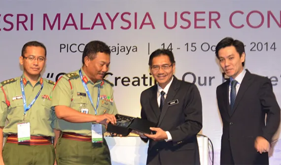
MIMOS partners with Esri on national security MIMOS, Esri Inc. and Esri Malaysia sign a memorandum of understanding that will bring the government's R&D efforts in the field of national security to new heights. Learn more
Halloween cemetery tour starring history's most notorious Should the dead rise today, which famous person would be on top of your list to meet? Learn more
News JUPEM wins SAG award for uGeo JUPEM's Defence Geospatial Division (BGSP) is selected from more than 400,000 organisations worldwide to win a global Special Achievement in GIS (SAG) Award. Learn more
News Pertamina EP receives international recognition State-owned oil and natural gas corporation, Pertamina EP, wins the 2014 Special Achievement in GIS (SAG) Award for their innovative use of GIS to improve operational efficiency. Learn more
News Geospatial tech supports mission-critical operations A world leading geospatial defence experts advises the region's national security stakeholders on how state-of-the-art mapping technology can help support mission-critical operations. Learn more
News New technology to future-proof Iskandar Malaysia The Iskandar Regional Development Authority (IRDA) is leveraging state-of-the-art technology to transform the region into Malaysia's next economic powerhouse. Learn more
News GIS shapes a brighter future for major electricity utility Australian electricity providers ensure power reliability and quality to millions of customers even when power supplies are disrupted by external factors -- from bird strikes to bushfires. Learn more