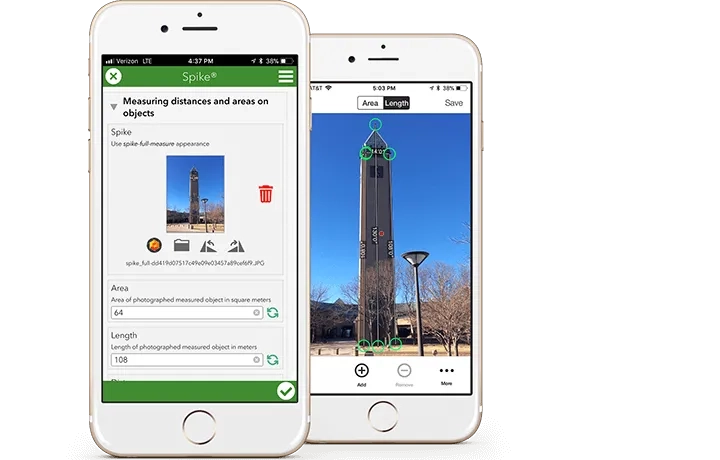

Seamlessly integrated with Esri's Survey123 for ArcGIS mobile app, Spike by ikeGPS is an affordable and easy-to-use smart laser measurement solution.
Designed for the novice to intermediate user
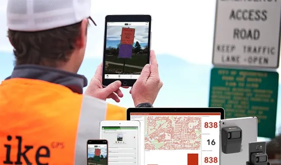
The inspecting, assessing, and reporting of assets or features is as easy as filling out a mobile form in the field, taking a photo with a smartphone or tablet, and automatically updating your geodatabase.
Everything at a glance
With Spike and Survey123, you can measure areas, heights, widths, elevations, distances to targets, distances between two points, and the offset GPS location of the features you need to map in ArcGIS.