You are here News and events News News Search news Search by year All20252024202320222021202020192018201720162015201420132012 Tags - Any - ArcGIS Pro: Essential Workflows3DABSAECAgileAgribusinessAgricultureAnalyticsAppsAppStudioArcGISArcGIS 10.5ArcGIS 10.6ArcGIS EnterpriseArcGIS Experience BuilderArcGIS Field MapsArcGIS HubArcGIS IndoorsArcGIS KnowledgeArcGIS OnlineArcGIS ProArtificial intelligenceAsset managementAugmented realityAustralian Bureau of StatisticsAutodeskBankingBIBig DataBig Data AnalyticsBIMBorder PatrolBusinessBusiness IntelligenceCadastreCalifornia CoastlineCitizen engagementCloudCloud computingCloud GISCollectorCommercialCommercial propertyCommunityConstructionContentCoronavirusCouncilCOVID-19CrisisCrowdsourcingDataData analyticsData visualisationDeep learningDefence and intelligenceDekhoDesignDigital transformationDigital twinDisruptive appsDronesEducationeLearningElectionElectorateElectricElectricityEmergency managementEmergency responseEmergency servicesEnergyEnergy, oil, gas and renewablesEngineeringEnterprise GISENVIEnvironmental managementEsriEsri AustraliaEsri Petroleum ConferenceEsri UCEsri Young Scholars AwardEventsFacility managementFederal governmentFinancial institutionsFinancial servicesFleet managementFood securityForestryGasGDA2020GDA94Geo hubGeoAIGeoAnalyticsGeoBIMGeographic datumGeographic Information SystemsGeospatial AnalyticsGetting Started with ArcGIS ProGISGIS for schoolsGIS managerGIS server softwareGIS technologyGIS trainingGIS web servicesGovernmentHealthHealth and human servicesHomeland SecurityIcon WaterIDLImageryImpact AwardsIndoor navigationInnovationInsights for ArcGISInsuranceInsurance and BankingInteractive mapsInternet of ThingsInternshipInteroperabilityIntroduction to ArcGIS Pro for GIS ProfessionalsIntroduction to GIS Using ArcGISIoTJack DangermondJavaScriptKerajaan Negeri SembilanLand AdministrationLand managementLaura DangermondLaw enforcementLive dataLive sensorsLocal governmentLocation intelligenceLocation-based analyticsLogisticsMachine learningMapping and chartingMapsMaritimeMediaMicrosoft AzureMiningMobileMobile applicationsMobile GISMount AgungNational developmentNational SecurityNot for profitOH&SOilOpen dataOpen platformOperational awarenessOz MineralsOzriPartnershipPetroleumPETRONASPlanningPortsPredictive analysisProductsPublic safetyPublic sectorQueensland GlobeRaster dataReal-time analyticsRemote sensingResilient communitiesResourcesRetailROISaaSSabah Lands and Surveys DepartmentSafe communitiesSAG AwardsSAPSAR ImagerySARscapeSatellite imageryScholarshipSensorsSituational AwarenessSmart citiesSmart communitiesSmart transportSmarterWXSolar eclipseSpatial data infrastructure solutionsSpeculative designStartupsState governmentStoryStory mapsSupply chain managementSurvey123Sustainable developmentTelcoTelecommunicationsTrainingTransformationTransportTransport analyticsTransport and InfrastructureTransportationUIUnearthed ChallengeUnited NationsUnmanned Aerial VehiclesUrban analyticsUrban planningUser experienceUser interfaceUser researchUtilitiesUtility networkUXUXGVirtual realityWaterWaterfallWeb GISWHO GIS powers up utilities sector Utilities across the Asia-Pacific region are taking advantage of advanced location-based analytics to fuel efficiencies, ensure workforce safety and deliver a more reliable electricity service. Learn more Esri earns top ranking in Forrester research report Esri has been recognised for setting a global standard in GIS technology with consistent innovation by advisory firm, Forrester. Learn more Learn what it's like to be an Esri Young Scholar Yan Yingwei shares his experience of the 2016 Esri User Conference in San Diego where he met Jack Dangermond and other GIS visionaries and learned from GIS industry thought-leaders. Learn more News Smart-mapping award for food security solution A final year PhD student from the National University of Singapore (NUS) wins the 2016 Esri Young Scholar Award for his developing sustainable solutions to ensure global food security. Learn more News Smart maps mitigate disease outbreaks Doctors and scientists are using smart maps to learn more about vector borne diseases threatening the world's tropical and sub-tropical regions. Learn more News Smart mapping technology: The silver bullet to Big Data Advanced smart mapping technology can save organisations from drowning in information and can help them obtain tangible returns from their business data. Learn more News Enhancing healthcare services with smart maps Hospitals around the world turn to smart maps to equip doctors and staff with the capability to understand and predict community health needs. Learn more News Redefining customer experiences with GIS Global players in the retail industry have adopted state-of-the-art smart mapping technology to optimise their business operations and Singapore retailers must do the same to remain competitive. Learn more Smart maps help build liveable communities Learn more Shaping the future of crime-fighting in Singapore Learn more Smart maps transforming crime fighting Learn more Fighting future crimes with smart maps Learn more Smart map offers rare glimpse of Singapore's past Learn more Global awards for tech-savvy students Learn more ArcGIS Pro to revolutionise desktop mapping Learn more Smart mapping technology can boost local government revenue Learn more Demand for smart mapping skill sets soars in Indonesia Learn more Smart mapping takes STEM education to new heights Learn more Major technology release takes smart mapping into new dimension Learn more 3D smart map critical to Singapore's Smart Nation journey Learn more Load More
GIS powers up utilities sector Utilities across the Asia-Pacific region are taking advantage of advanced location-based analytics to fuel efficiencies, ensure workforce safety and deliver a more reliable electricity service. Learn more
Esri earns top ranking in Forrester research report Esri has been recognised for setting a global standard in GIS technology with consistent innovation by advisory firm, Forrester. Learn more
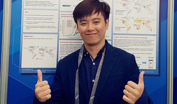
Learn what it's like to be an Esri Young Scholar Yan Yingwei shares his experience of the 2016 Esri User Conference in San Diego where he met Jack Dangermond and other GIS visionaries and learned from GIS industry thought-leaders. Learn more
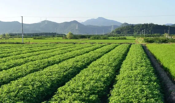
News Smart-mapping award for food security solution A final year PhD student from the National University of Singapore (NUS) wins the 2016 Esri Young Scholar Award for his developing sustainable solutions to ensure global food security. Learn more
News Smart maps mitigate disease outbreaks Doctors and scientists are using smart maps to learn more about vector borne diseases threatening the world's tropical and sub-tropical regions. Learn more
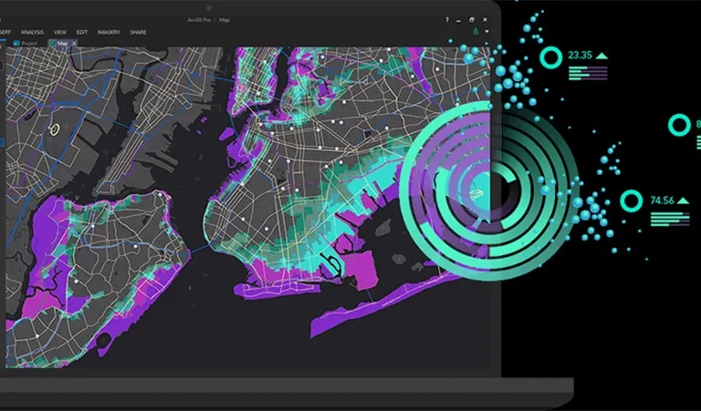
News Smart mapping technology: The silver bullet to Big Data Advanced smart mapping technology can save organisations from drowning in information and can help them obtain tangible returns from their business data. Learn more
News Enhancing healthcare services with smart maps Hospitals around the world turn to smart maps to equip doctors and staff with the capability to understand and predict community health needs. Learn more
News Redefining customer experiences with GIS Global players in the retail industry have adopted state-of-the-art smart mapping technology to optimise their business operations and Singapore retailers must do the same to remain competitive. Learn more